Niha Al-Chouf

Where History Breathes in the Mountains

1100m Above Sea Level
37.3 Square Kilometers
1256 First Historical Record
Discover Our Heritage

Welcome to Niha Al-Chouf

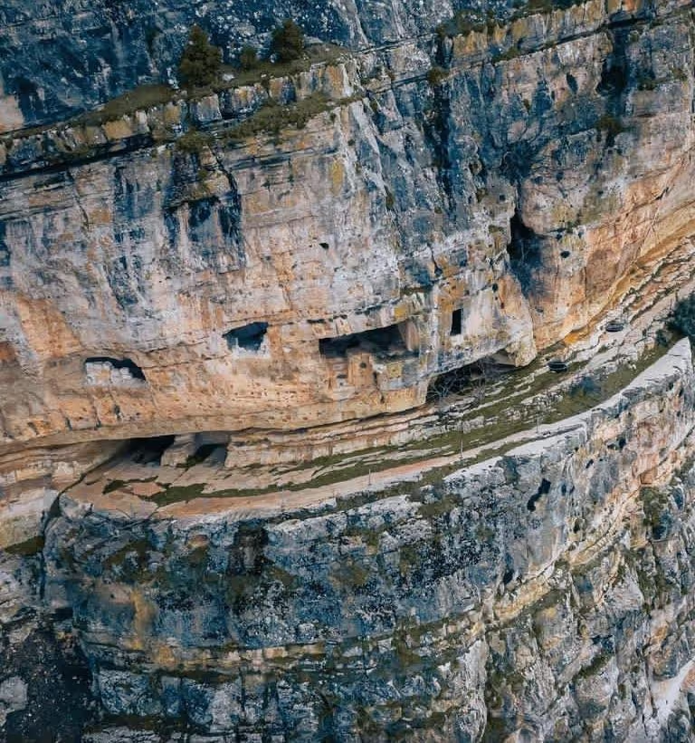
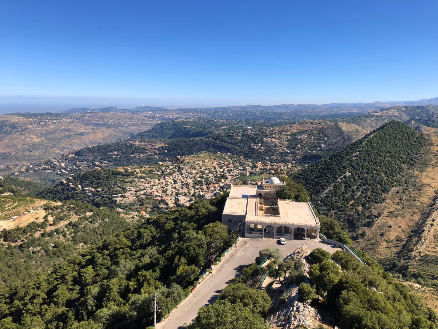
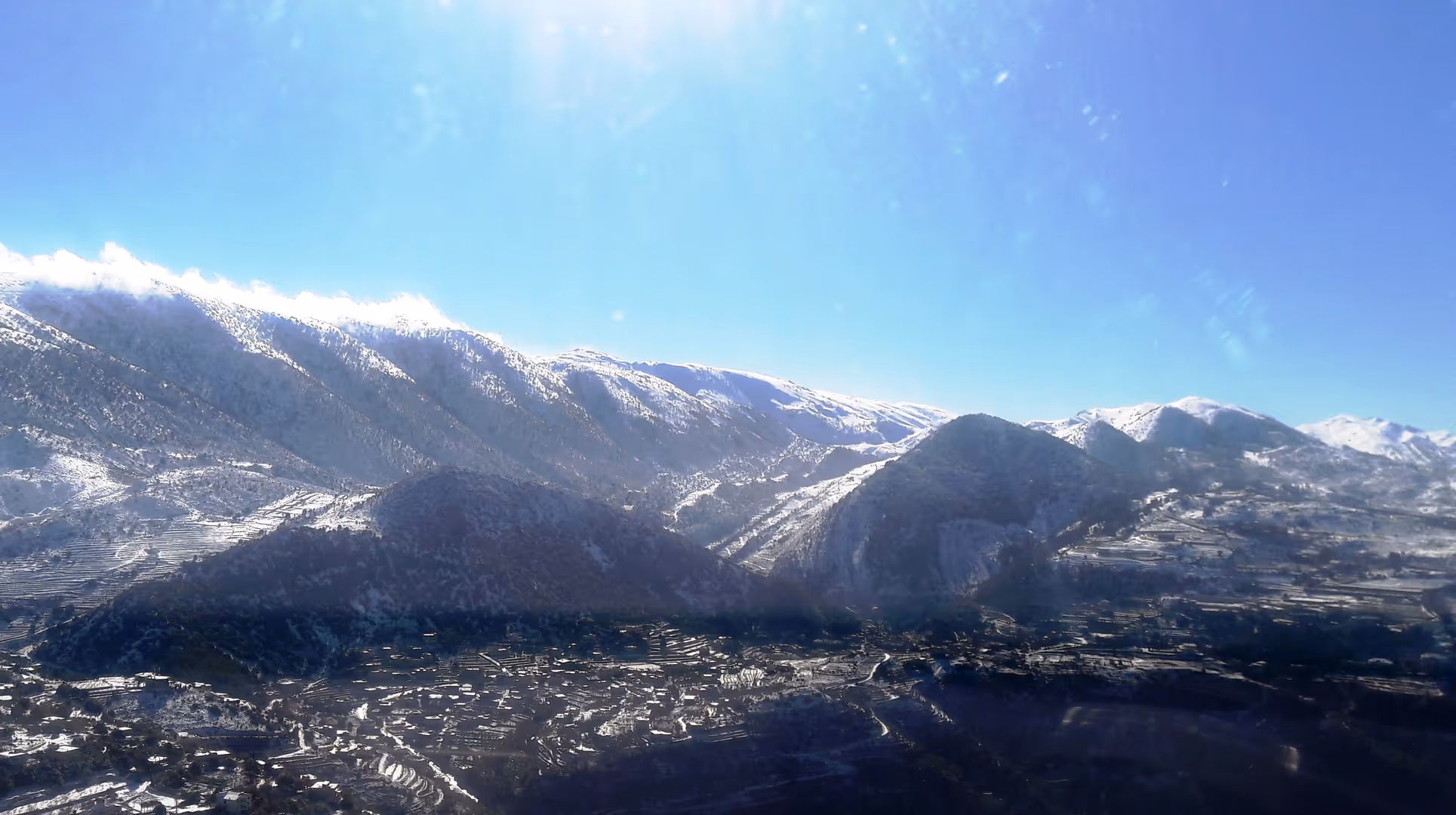
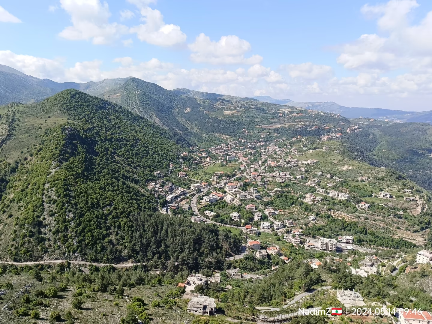
The village of Niha is located in Mount Lebanon Governorate, within the upper section of the Chouf District, known as 'Upper Chouf'. It sits on the western slope of the Mount Lebanon mountain range at a meeting point between three governorates: South Lebanon, Mount Lebanon, and Bekaa. Rising about 1,100 meters above sea level and surrounded by hills and plateaus, Niha is known for its vast territory stretching southward to the borders of Jezzine District, making it one of the largest Lebanese villages in terms of area at 37.319 square kilometers.

Distances from Major Centers:

  • About 22 km from Beiteddine (District Center)
  • About 61 km from Baabda (Governorate Center)
  • About 60 km from Beirut (Capital)

Village Borders:

  • North: Jbaa and Bater (Chouf)
  • West: Bater (Chouf), Aaray, Jezzine, Kfarhouneh and Ain Majdalayn
  • South: Jezzine, Kfarhouneh, Ain El-Tineh, Deir El-Mzayra'a and Ain Majdalayn
  • East: Bab Mareh, Aitanit, Mashghara and Ain El-Tineh

Origin of the Name:

There are differing opinions regarding the origin of the name "Niha". Some attribute it to the Arabic root "Niḥa" (نيحة with a "tā’", not an "alif"), meaning "swaying branches", as in the phrase "the branch swayed" (ناح الغصن), with the verbs "yanīḥ", "nīḥan", and "nīḥānan" indicating motion or swaying. Others interpret it as being purely of Syriac origin, "Niha", meaning "calm", "peaceful", or "gentle". Grammatically, it is the passive participle from a shared Semitic root, corresponding in Classical Arabic to "nāḥ", and in Lebanese dialect to "nayyaḥ" or "tnayyaḥ", meaning "to relieve" or "to rest". In Lebanon, there are four villages that share the name Niha, including one in the North Governorate (Batroun District), one in Bekaa Governorate (Zahle District), and another in South Governorate (Tyre District). However, Niha in Chouf is considered the largest and most important among them due to its historical sources, geographical significance, and natural resources.

Niha Al-Chouf Village Panorama
Village Panoramic View
Niha Al-Chouf Official Coat of Arms

Official Village Coat of Arms

Historical Heritage

Journey through centuries of civilization

Ancient Roots

Originally, the village consisted of small homes and ruins scattered across areas like Halkoum, Rashmaya, Sarsourit, Shaqif, Khirbet Hani, Batoum, and Jabbour, inhabited by local peasants and farmers with their livestock. The village became well known for cultivating wheat and fruit trees, especially walnuts.

654 AH / 1256 AD

First Historical Record

The oldest document mentioning Niha dates back to 654 AH / 1256 AD, during the early Mamluk era. The village was referenced in a decree issued by King Al-Mu'azzam Izz al-Din Aybak, the husband of Queen Shajar al-Durr and the first of the Mamluk sultans in Egypt, addressed to Emir Saad al-Din Khidr bin Muhammad bin Haji bin Bahtur, one of the Tanukhid Arab emirs.

17th-18th Century

Natural and Historical Importance

Niha was renowned for its stunning nature, vast territory, abundant springs, and rich biodiversity—both forest and animal life—making it a prominent recreational spot visited by noble families and their entourages for hunting and relaxation. It gained prominence in several historical periods, especially between the 17th and 18th centuries. Historian Dr. Riad Ghanem documented detailed historical events related to the village in his book “Niha al-Chouf in History: Land and People”, tracing its history from before the Arab conquest of the Levant, through the Crusader and Ottoman eras, and into the 19th century.

1932

First Municipal Council

The first municipal council was established by Decree No. 450 on August 3, 1932, marking the beginning of organized municipal work and various development projects in the village.

1952 - 1990

Borders Demarcation and Civil War Period

The village's borders were officially demarcated in 1952. During the Lebanese Civil War, the village was affected by significant internal and external migration. However, after 1990, life returned to normal as expatriates contributed to reconstruction and revival, with residential expansion increasing significantly.

Historical Landmarks

Discover the architectural and natural marvels of Niha

Fortress

Niha Fortress (Shaqif Tirun)

One of the most significant historical fortresses, carved into a towering cliff in the southern Chouf region. Known for its strategic role during Emir Fakhr al-Din II's conflict with the Ottoman Empire in the 17th century.

17th Century Fortress
Prophet Ayyoub Shrine

The Shrine of Prophet Ayyoub

A sacred shrine located 1,340m above sea level, overlooking breathtaking scenery to Sidon and Tyre. One of Mount Lebanon's oldest religious sites, associated with Prophet Ayyoub's trials and the legendary healing spring.

Medieval Period Religious Shrine
Toumat Niha

Toumât Niha

Two prominent cone-shaped mountain peaks reaching 1,700m and 1,650m altitude. These natural landmarks offer stunning views over the sea and plains extending to Sidon and Tyre, with rich coal mining history.

Natural Mountain Peaks

Borj al-Toumat (Historical Watchtower)

A former strategic watchtower that once stood on one of the Toumât peaks. It served as a crucial defense point for protecting the region from invasions during wartime, though no records of its construction survive.

Historical Watchtower

Historical Coal Mines

Remnants of significant coal extraction operations from the early 20th century. During WWI, over 1,300 tons were transported via the famous "De Deboul Line" route to the coast.

20th Century Industrial Heritage

Explore Niha

Interactive map showing historical landmarks and points of interest

Niha Al-Chouf Municipality

Foundation and Historical Development

Official Establishment

During the era of the Ottoman Mutasarrifate in Mount Lebanon, the first municipalities were established, with Deir al-Qamar being the earliest, founded in 1864. This was followed by a wave of municipal councils being formed across various Lebanese towns. Within this context, Niha Al-Chouf Municipality was officially established by Decree No. 4907 dated April 22, 1929, following the approval of the Chouf Administrative Council, and based on Decision No. 1208 issued on March 10, 1922. The jurisdiction of the municipality was defined within the village of Niha (Chouf District), and Sunday, May 12, 1929, was set as the first date for electing its members.

French Mandate Period

During the French Mandate period, the Law of Mukhtars (village heads) was enacted in 1928, alongside municipal and local council laws that granted these entities official local representation. Their responsibilities included maintaining public order and cleanliness, distributing taxes, safeguarding public health, and ensuring the election of a mukhtar for each village.

Current Structure

Today, the Niha municipal council consists of 15 members, and the local elective body includes three elected mukhtars. Municipalities, including Niha Municipality, contributed significantly to consolidating local governance and were part of the administrative decentralization policy, which encouraged residents to participate in managing their local affairs and organizing their villages.

15
Municipal Council Members
3
Elected Mukhtars

Support Niha Al-Chouf

Your contribution helps preserve our heritage, maintain historical sites, and support community development projects.

Contact Municipality for Support

Office Niha Municipality Building

Community Supporters

Name Heritage Preservation Fund
Family Community Development
Name & Name Infrastructure Support
x Community Supporters
x Active Projects

Every contribution helps preserve our cultural heritage for future generations. Contact the municipality to learn how you can support ongoing community projects.

View All Credits & Supporters
×